_When it Rains, it Floods
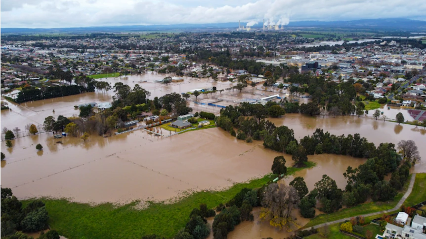
Over the past week, flooding has devasted communities throughout Victoria. Many were surprised as their homes were inundated with water, surpassing levels most people had not seen in their lifetime.
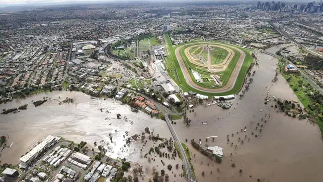
Not long after the banks of the Maribyrnong River broke around lunchtime last Monday, photos of Flemington Racecourse were published online. The dry, green grass of the Racecourse contrasted starkly with the muddy water reaching near capacity of the retaining wall around the site. Many locals are reported to be furious as they question whether the Racecourse retaining wall has re-directed stormwater flow / the previous floodplain and resulted in extensive flooding of the surrounding residential area.

A review into the retaining wall and whether it contributed to the flooding has since been announced. You may recall however, that when the wall was proposed, flood impact concerns were largely dismissed by the drainage authority and while we are interested in the outcome of this review, we wonder if Melbourne Water is the appropriate ‘independent’ body to be conducting it.
Meanwhile, away from the Melbourne metropolitan area, residents of parts of regional Victoria are grappling with the aftermath of flooding or in the case of some towns, the threat of still rising rivers and the possible impact on towns.

Based on these recent events, it would appear that specialists and politicians will need in the future to consider more significantly changes in flood modelling and the impact on development in lower lying areas, including areas that in history were not considered flood risks.
The impacts of climate change are becoming evermore apparent as extreme weather events, including bushfires, floods and heatwaves, intensify in severity and frequency and this has major new implications for new development decisions.
